Egypt
Egypt has progressively developed national plans for climate change adaptation and mitigation. While Egypt’s climate planning is cognisant of changes to the hydrological cycle, the Tracker has helped identify ways to build resilience.
Egypt is located in the north-eastern corner of Africa and has a coastline of 3,500 km along the Mediterranean and the Red Sea. Egypt’s coastal zones extend for over 3,500 km along the Mediterranean and the Red Sea. The Mediterranean shoreline is most vulnerable to sea-level rise due to its relatively low elevation compared to the land around it.
Egypt’s population growth is n driver to water demand. Egypt’s population reached 21.5 million in 1952, doubling to 43.3 million by 1980, another doubling to 86.4 million by 2012 and now stands at 104 million. More than 95% of the population is clustered within 20km along the banks of Nile Valley and delta on 3% of the land. 40% of the population is urban.
Egypt is already severely impacted by and susceptible to droughts, which are expected to be more frequent and pronounced particularly in the sources outside its borders. The country is expected to become hotter and drier under a projected future climate.
Egypt has progressively developed national plans for climate change adaptation and mitigation. In the wake of renewed efforts for climate change, Egypt has directed its mitigation and adaptation efforts to develop a general framework for the national strategy for climate change in addition to incorporating the strategy into the sectoral labour training plans of other ministries.
-
Egypt is extremely vulnerable to the effects of climate change due to its large population and densely populated areas, particularly along the Nile Delta, which is threatened by sea-level rise. The vulnerable areas include agriculture, coastal zones, water resources, human settlements, and health5. Egypt‘s current dependence on the Nile River’s water makes the country vulnerable to rising temperatures, reduced rainfall for the upper Nile sources, and the eastern Mediterranean coastal zone.
The World Bank projects7 the following temperature and rainfall changes for Egypt:
Changes in annual mean temperature are projected from 1.8°C to 5.2°C by the 2080s. Maximum temperatures are expected to increase by 2.1°C to 5.7°C by the 2080s, with minimum temperatures increasing by 1.5°C to 4.6°C during the same period.
Heat waves are anticipated to increase significantly in their severity, frequency, and duration, with them expected to last an additional 9 days to as much as 77 days. The cold spells are expected to decrease.
The reduction in precipitation, observed over the past 30 years, is expected to continue by the end of the century, with projections indicating a trend of even longer dry spells and the possibility of dry spells increasing by 75 days by the 2080s.
The annual mean precipitation is expected to decrease, while the intensity of flash floods is expected to increase by the 2080s.
Under a high emissions scenario, Representative Concentration Pathways (RCP) 8.5, it is projected that by the 2030s, an additional 1.1 million people are at risk of flash floods due to changing precipitation patterns and extreme rainfall events.
Our Approach
The Water Resilience Tracker was been applied to the National Water Resource Plan (NWRP), the Updated Nationally Determined Contribution (NDC), the National Climate Change Strategy, and the Climate Change Adaptation Strategy.
The eight documents were assessed to map how adaptation is addressed — or omitted — within national plans, identifying gaps for potential improvements in the analyzed documents. The assessment has 6 general steps (see Figure 1).
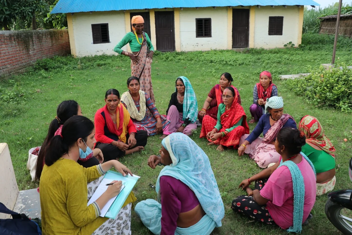
The primary tool for content analysis is the Water Resilience Tracker Form, which contains 153 questions distributed across four sections. Responses were based on an innovative dual process combining artificial intelligence tools with human evaluation capacity.
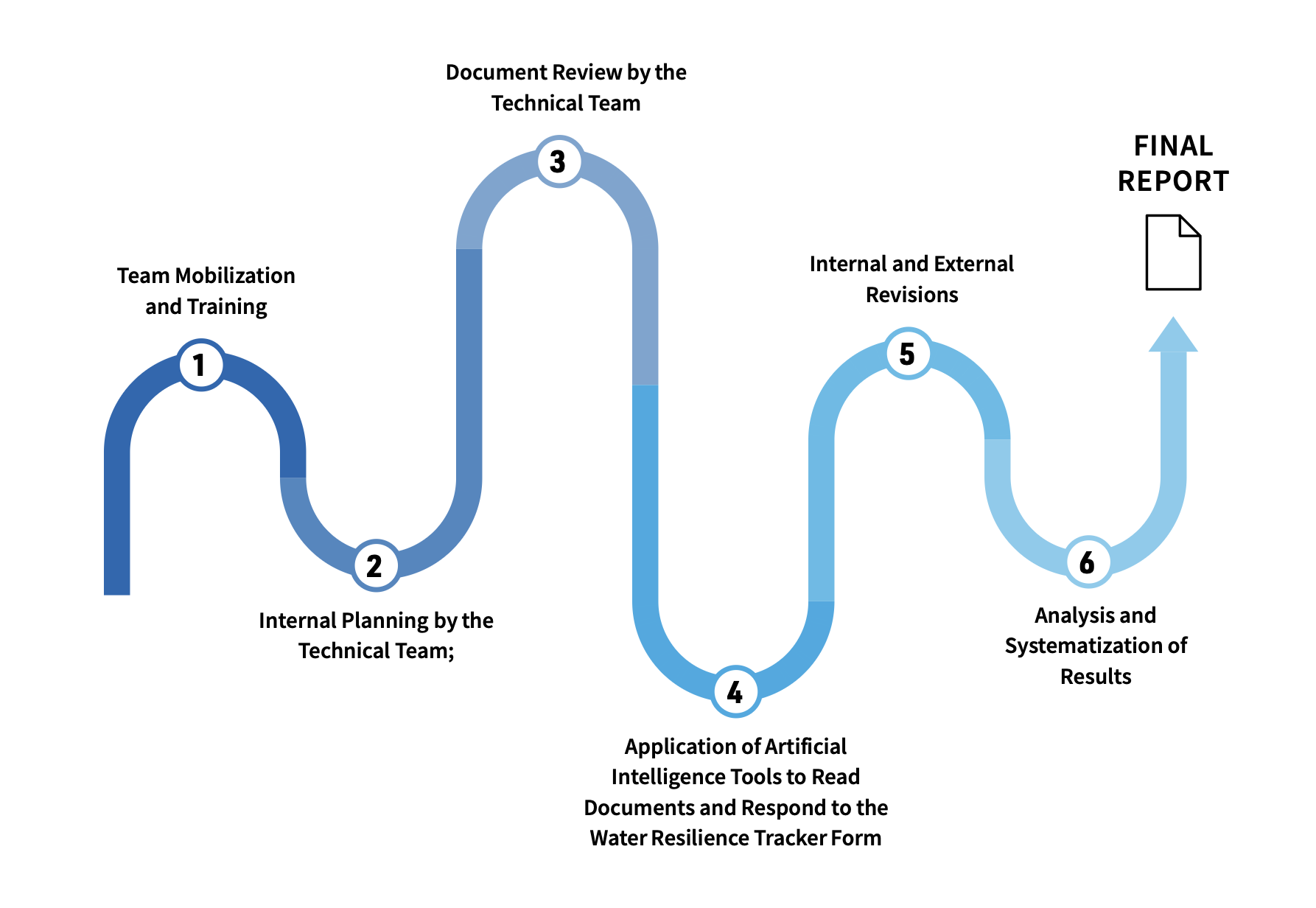
Figure 1. Flowchart of the methodological steps
Impact of Tracker tool
The application of the Water Resilience Tracker provided interesting outcomes, with some clear strengths, challenges as well as opportunities to improve integrated climate change planning.
While Egypt’s existing plans and frameworks are cognisant of the changes to the hydrological cycle, the emerging trends and practices highlighted will go a long way in informing and updating the water and climate change policy and legislative framework and the renewal of development plans and strategies.
Next Steps
Applying the Tracker to Egypt’s water and climate sector reveals how deeply adaptation of different social, economic and environmental sectors to climate change depend on innovative water resources management, and careful stewardship of the quality and quantity of limited water.
Though still improving in technical efficiency through canal lining and improved management including distribution of water, Egypt’s irrigation sector already achieves very high levels of water reuse, which is now enhanced by wastewater treatment, desalination, and channeling of sporadic stormwater to productive use.
Expanding this policy to require more efficient water use in other sectors, as well as replicating the success of community-managed initiatives for the protection and nature-based restoration of Egypt’s invaluable delta region against sea level rise and wind erosion will be critical to Egypt’s ability to withstand adverse impacts of climate change and offer opportunity to reverse decades of environmental degradation.
The role of water in these processes is unequalled and further portrayed in Egypt’s ambitious low-carbon energy efficiency commitments.

This report presents and evaluates the first application of the tool in Egypt’s general and sectoral strategic plans.
The report provides a detailed overview of the Water Resilience Tracker’s work in Egypt including regional challenges and detailed findings.